It is about a 2,600 foot climb to the top--four miles up and four miles down--altogether not so bad for the reward. Most of the climbing is done in the first (1,100 feet) and last miles (another 1,200 feet or so).
The trail once you finish that first mile, which is a doozy of a climb.
Looking southeast towards the Clark Fork River valley. Yes, this area of the mountainside was burned by a wildfire, but I do not recall when. Views like this enable one to understand why Montana is nicknamed "Big Sky Country."
Unnamed lakes in the Engle Lake basin
Another shot of the basin with more of the Cabinets in the background.
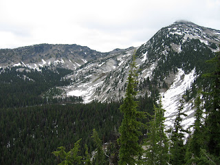
This is the same shot taken in June of 2007 with a considerable amount of snow still on the ground. We hiked up to a perch just above Engle Lake, but decided that the snow was too deep for us to continue on. The next two photos are of our destination, Engle Peak, taken from the trail above Engle Lake:
This one was taken in the the summer of last year.
While this one was taken in June of 2007.
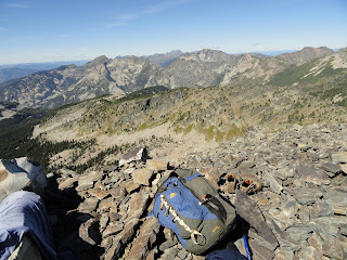
View from the top of Engle.
More views from the top.
Yet another view from the top looking along a ridge extending east from the peak.
This pack is in a lot of photographs with nice backgrounds.
Engle Lake.
Another shot of Engle Lake and the basin.
The spot of blue in the right center of this photo is Rock Lake, a favorite destination of ours, which we try to hit every year. We have hiked the trail on both beautiful sunny days and in the middle of an early fall snowstorm. The trail up to Rock Lake passes through a lovely meadow filled with wildilfe, colorful flora, and the remnants of a mine, including an open mine shaft (we will write in more detail about the trail later). Above the lake to the right (east) is Ojibway Peak, which reminds H of Jabba the Hut from Star Wars fame. To the left of the lake is Rock Peak and between the two peaks is St. Paul Pass. The round peak on the left hand side of the photo is 7,700 ft St. Paul, which H conquered back in 2007 while I hung out with our old husky Harley, who at the time was too old to climb mountains.
Closer view of Rock Lake and the surrounding mountains. The high peaks in the background are Snowshoe and A peaks, the crown jewels of the Cabinets.
H on top of Engle looking towards Lost Horse Mountain and Lost Buck Pass (the small "U" in the middle of the photo), which we have climbed from the other (eastern) side. In the valley below the "U" is the Swamp Creek Drainage and Lake Wanless, the largest lake in the Cabinets. And here is a view of Lake Wanless from Lost Buck Pass:
And here is Lost Buck Pass. The lake is Upper Geiger:


No comments:
Post a Comment