Monday, July 25, 2011

Selkirk Crest Hike in the Snow

As we noted in previous posts, we recently spent a few weeks at our cabin in northern Idaho.  Hiking was generally disappointing because of the heavy snow still on the ground in the higher elevations and the amount of runoff in the mountain creeks and rivers.  Many creeks were simply not crossable, and that cut out about 80% of the trails we planned to hit this year.  The other 20% were covered in heavy snow, and while we could hike those, climbing up a few thousand feet on top or through heavy, wet spring and early summer snow is not so much fun.  It is a slog.  Count on falling through on a regular basis (T) or sliding off (H) and getting wet feet no matter how good you think your boots are.  So, I guess what we're saying is that we do not have many photos to share this year beyond what we posted under the entry "Out in the Wilderness." The best hike, and therefore the best photos, are probably from a hike up to the Selkirk Crest on the 12th of July near Roman Nose Mountain.  Roman Nose is usually fairly accessible if you don't mind going off-trail.  Simply hike up to the Lake number 2 (only about 1.5 miles), then make the 700-foot climb up to the ridge above, which you can do on two feet with a little sweat, but without hands or ropes.  From there, turn left and walk the rock-strewn ridge to Roman Nose at 7,260 feet or turn right and walk to a lesser un-named peak which tops out at 7,010 feet.  We would choose the lesser peak largely because of all the snow. 

The Roman Nose basin has 3 lakes.  This is the first lake, called Roman Nose Lake Number 3.   It is a short walk from a parking lot which you can drive to with a high clearance vehicle. The road was blocked with snow right before the parking lot and the lot itself was still under snow, but we were able to get close enough.
The headwall of the drainage for the lakes below Roman Nose.  The other 2 lakes sit up in the hanging valley above the wall (Lake number 1 is just out of sight at the top of the wall) .  Barely visible in the right center of the photo is a waterfall from the upper lakes, which could easily be heard from a mile away. 
Our destination.  Roman Nose peak is on the left; the right peak is unnamed, but where we ended up after climbing up to the ridge between the two peaks. 
The trail.
Roman Nose Lake Number 2 with Roman Nose towering above it.  Interesting story about Roman Nose.  There were fire watch towers on top of the peak from 1917 to 1999.  During the Sundance Fire of 1967, a young 18-year-old fire watcher posted to the peak escaped a massive wall of flames fanned by fire-induced wind gusts of up to 95mph by leaping over the edge and hiding under a rock overhang.  He later said, "A rock shelf had an overhang, and I wedged back under it as far as I could.  Flames began roaring over it.  I saw blazing branches as long as my arm fly past the overhang and down into the forest around the Roman Nose Lakes."  Two other men were not so lucky and were killed during the firestorm, which fire burned almost 56,000 acres.  At its height, the fire moved 10 miles in 3 hours, according to the Summer 2002 edition of the Sandpoint Magazine.
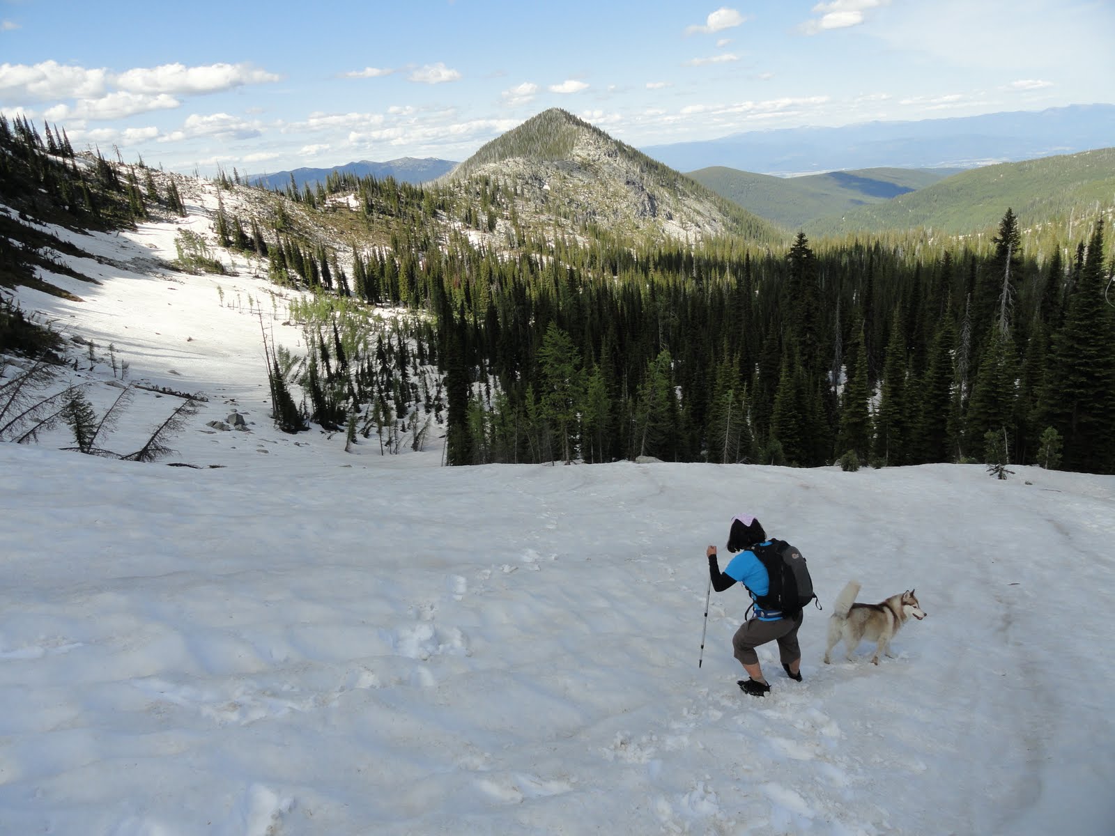
Heading up the 700-foot climb towards the saddle between the two peaks.  H was not enjoying the snow, but the dog certainly was.
Another look at our destination, this time from the saddle.
Chimney Rock, one of the iconic peaks of the Selkirks.
Roman Nose lake number 2 from the top.
The top looking north towards Canada.
The 7 Sisters and Harrison Peak.
Hardy vegetation on the peak.
Another shot from the top.  That is some view.
On our way down.

Thursday, July 21, 2011

Trails, Forts, Wagon Boxes, and a Massacre: 1860s Indian War Sites in Wyoming


The area bisected by Interstate 90 between the town of Buffalo, Wyoming and Billings, Montana also provides an interesting backdrop to America's westward expansion and the resulting clash with the native Indian tribes from the 1860s to the early 1890s, this time those of the Northern Plains, including the Sioux, Cheyenne, and Arapahoe.  In an area no more than about 100 miles north and south of the Montana-Wyoming state line and about 50 miles east and west of I-90, one can visit the sites of the Battle of the Tongue River (1865), the Fetterman Massacre or “Battle of the Hundred Slain” (1866), the Wagon Box Fight (1867), the Battle of the Rosebud (1876), and the Little Bighorn (1876), plus a few other smaller and lesser-known sites of clashes.

A good place to start is Fort Phil Kearny between Buffalo (an interesting mix of cowboys, outdoor lovers, and artsy types) and historic Sheridan, Wyoming.  Kearny guarded the Bozeman Trail from 1866-1868.   The Bozeman Trail connected the gold fields of Montana with the Oregon Trail and generally followed the current trace of I-90 and I-25 between Bozeman, MT and Wyoming.   Kearny, along with two other posts (Forts Reno and C. F. Smith), protected travelers on the Trail, tried to prevent intertribal warfare between the Indians inhabiting the area, and attempted to draw Indian attention away from the transcontinental railroad construction to the south. Soldiers stationed at Kearny participated in a number of fights in the area in what was known as Red Cloud's War (1866-1868), including the Wagon Box Fight and the Fetterman Massacre. The fort and the Bozeman Trail were closed in 1868 in a treaty with the Indians because both had outlived their usefulness with the advance of the Union Pacific Railroad to the south. Once the Army abandoned the fort, the Cheyenne burned it so only traces and a few relics remain. Meanwhile, the treaty established a huge reservation encompassing parts of eastern Wyoming and western South Dakota, and the government promised to protect the Indians “against the commission of all depredations by people of the United States.”

A sketch of Kearny.
But there isn't much left today.  It is currently a state park with an interpretive walking path through the site, as well as a museum.  Placards offer insights into life on a frontier outpost in the 1860s.  Trust me, life was not all that exciting.  Between the occasional skirmishes with Indians, boredom was the chief enemy.  The bleak country and cold, wind-swept winters certainly did not help.  Alcohol was a frequent solace and desertion rates were very high. 

A reconstruction of part of the fort's wall.  A number of archeological digs have been undertaken in and about the site.
The park's museum is small, but informative and has some impressive displays.


Close by are the sites of two battles the soldiers of Ft. Kearny took part in:
 
The Fetterman Massacre or the Battle of the Hundred Slain:  In December of 1866, a military force of 81 men under Captain William J. Fetterman was wiped out here by a large force of Sioux, Cheyenne, and Arapaho warriors.  Fettermen and his men had ridden out of Ft. Kearny to rescue a woodcutting wagon train under attack.  What they did not realize is that the attack was a ruse to draw a column from the fort into an ambush.  When Fettermen and his men rode over this crest, they were attacked by a force of Indians estimated from 1,000 to 2,000 strong.   No one in Fetterman's force survived.  Ironically, Fetterman, a Civil War veteran, had boasted he could with 80 men "ride through the Sioux nation."  I seem to recall a British general saying something similar during the Revolutionary War.  I don't think that worked out very well either.

A close up of the monument.

Fetterman and his men advanced along this ridge prior to being forced back.   Occasional interpretive signs along the trail in the photograph tell the story of the battle and what it was like for both the doomed soldiers and the victorious Indians.
The area contains traces of the Bozeman Trail.

The Indian force attacked largely from the left. The last remants of Fetterman's force were killed around the area where the monument is currently located.

The Wagon Box Fight:  There isn't much to see here, but somewhere in this vicinity (the exact site is still disputed), a large Indian force (perhaps 800 Sioux) in August of 1867 attacked another woodcutting party.  This time, however, some 32 men (26 soldiers and 6 civilians) armed with breechloading rifles and taking cover inside an oval of wagon boxes used as a stock corral beat off the attack.   There is no interpretive trail here, but the placards you see do tell the tale of the battle.

A wagon box (in case you were wondering).

And close-up of the monument commemorating the fight.

Tuesday, July 12, 2011

Opening Up the Old Northwest: Indian War Sites of Ohio and Indiana

**This is the first of three blog entries** about visits to sites where the US military fought Indians/Native Americans to open up the west for American expansion.  One caveat - Indian Wars, whether right or wrong, are a part of our country's history. I am interested in them for this reason alone. I don't want to spend time discussing how politically incorrect attitudes were back then, the attitudes were what they were and our nation is what it is as a result.   Okay, back to the blog, the first part of which will focus on a few sites in what was known as the Old Northwest, while the second will take a look at places in the Wyoming-Montana area.

Every year one or both of us drive out to our cabin in northern Idaho. It is a long drive of almost 2500 miles and takes about three days depending on how hard we push ourselves. Yes, 2500 miles is a serious amount of driving, and yes, the monotony of the Midwest states with their seemingly endless fields of corn and the vast emptiness of western South Dakota and eastern Montana can challenge any driver's ability to keep their eyes open. Thank goodness for audio books to help pass the time because radio stations across the country seem to all be the same—bad—except for perhaps KPND, the “Inland Northwest's Progressive Radio.” And don't get me started on the talking heads that proliferate—or shall I say pollute—the country's AM stations. To add a little something to the drive besides audio books and when we are not trying to get out there as quickly as possible, we try to hit a few stops along the way. One year, it was Laura Ingalls Wilder sites, while another was devoted to antique shops scattered along I-70 and I-90. This year, I (T) drove by myself (ok, I had a dog with me) and decided to hit a few Indian War sites along the way, first in what was known as the Old Northwest and then in the Wyoming-Montana area. 

I started with the town of Fort Recovery, Ohio, which is about 50 miles north of I-70 near the Indiana state line. It is a quaint little town smack dab in the middle of farming country. Check out the fantastic movie "Hoosiers," and you will get my drift.  It is named after a genuine Fort Recovery, built by the US Army in the 1790s. More importantly, the town is the site of General Arthur St. Clair's little-known defeat at the Battle of the Wabash in October of 1791 at the hands Chief Little Turtle of the Miami tribe. It is fascinating that the battle is so little known because St. Clair not only lost, his force was nearly wiped out in what continues to be one of the worst defeats in US military history; certainly the worst in the Indian wars, including Custer's much more well-known disaster on the Little Bighorn almost 85 years later. Out of his force of some 1,400 men, St. Clair lost around 900, and it could have been much worse had the Miamis pressed their victory. When then President George Washington read St. Clair's dispatches on the disaster, he said the general was “worse than a murderer.”

One of the consequences of St. Clair's defeat was an increase in the size of the federal army (a contentious issue in the late 18th century) with the formation of what was called the Legion. The Legion was placed under the command of the General “Mad” Anthony Wayne of Revolutionary War fame. To make a story going over a few years short, Wayne took the Legion back to the area of St. Clair's defeat, built Fort Recovery on the site of the battle, defeated a Miami attack on the fort, and launched a campaign against the Miamis to clear the Northwest Territory (largely the current state of Ohio and part of Indiana), culminating in the decisive victory over the Indians at the Battle of the Fallen Timbers near present-day Toledo in August of 1794.

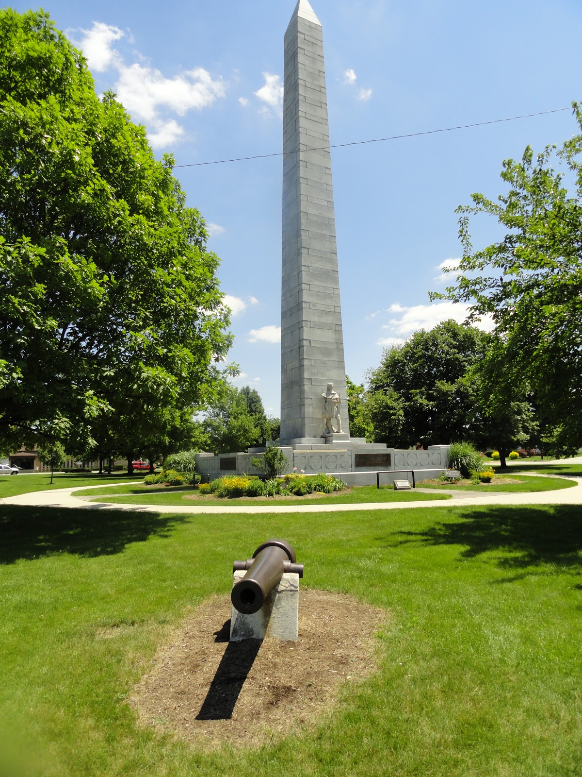
In the town square is this well-maintained park and monument to both St.Clair's losses and a subsequent victory by Anthony Wayne when the Miamis unsuccessfully attacked Fort Recovery.


At the site of both St. Clair's defeat and the original Fort Recovery, there is a partial replica of the fort's stockade walls and a nice, impressive little museum recounting the battles and the history of the area's original inhabitants.  The museum also contains a considerable number of artifacts found in the local area.  Oh yea...special thanks to the lady running the museum that day.  It was a very hot day, and she let me bring the dog into the air conditioned museum.   I cannot imagine that happening on the east coast. 


Next on the agenda was the site of the 1811 Battle of Tippecanoe, just off I-65 in Lafayette, Indiana, another key battle in the effort to open up the area of the Old Northwest for American expansion. Prior to the War of 1812, a new confederacy of Indian tribes under the great Shawnee chieftain Tecumseh and his brother Tenskwatawa (“the Prophet”) resisted the efforts of Indiana Territory governor William Henry Harrison to secure title to Indian lands to provide room for more settlers. Harrison wanted enough settlers to qualify the territory for statehood and negotiated numerous land cession treaties with area Indians, including the Treaty of Fort Wayne on September 30, 1809, in which several tribal leaders sold 3 million acres to the US. The Treaty, however, was opposed by Tecumseh and Tenskwatawa and by 1811, they were preparing for war by trying to build a confederation of Indian tribes and discussing an alliance with the British, who were doing their own scheming with the Indian tribes against the US, including providing arms. Learning of Tecumseh's and Tenskwatawa's plans and hoping a show of force would make the Indians sue for peace, Harrison marched west with a strong force of US Army soldiers and militia against their main village, called “Prophetstown,” in the fall of 1811. With Tecumseh absent trying to recruit other tribes to the cause, the Prophet on 7 November preemptively attacked Harrison's camp at Tippecanoe and was defeated. The battle is often portrayed as a decisive Indian defeat, but while the Indian federation was severely damaged, it held together under Tecumseh and fought with the British against the US in the War of 1812. It would ultimately fall apart with Tecumseh's death at the October 1813 Battle of the Thames in Ontario, Canada. Tippecanoe also helped inflame public opinion against the British prior to the War of 1812. Meanwhile, Harrison would use the slogan “Tippecanoe and Tyler too” to remind people of his heroism during the battle when he ran for president in 1840.

The site of the battle is now a state park with a museum, monument, and markers honoring US military officers killed during the battle.  Unfortunately in this case, I was not able to visit the museum, it having closed about 15 minutes before my arrival.


Stayed tuned for part 2 of Indian War travels to sites in Wyoming and Montana.

Saturday, July 9, 2011

Out in the Wilderness

Apologies for the lapse in postings, but we are out in the woods and mountains of Idaho and Montana.  Unfortunately, winter just ended here and spring runoff is near peak.  The high trails are still under a great deal of snow, while many of the creeks and streams are uncrossable, unless you have a death wish.   We have managed to slog our way up a few trails, however, and here are a few photos.  We will follow up with more pics and tales later.

One of the easier creek crossings.

Can you believe this is July 7th??  Heart Lake in the Bitterroot Mountains of Montana. 
The view from snow-covered Vermillion Peak in the southern Cabinet Mountains, Montana.


A creek crossing in Idaho's Selkirk Mountains we did not make.  This particular creek is usually an easy hop.  What is missing here is the tremendous amount of noise that much water rushing down a mountain makes.
Snow-covered trail in the Selkirks.